Maps & Cartography
Four maps that trace Chile's story — from the earliest printed map made by a Chilean, to how the country is mapped today.
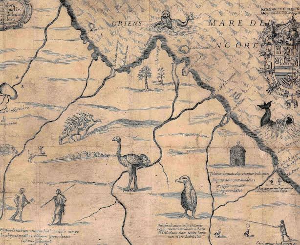
Tabula Geographica Regni Chile (1646)
Created by Chilean Jesuit priest Alonso de Ovalle, this is the first printed map of Chile made by someone who actually lived there. It shows the narrow colonial territory stretched between the Andes and the Pacific, decorated with illustrations of volcanoes, native wildlife, and scenes from Spanish-Mapuche relations.
Library of Congress, n.d.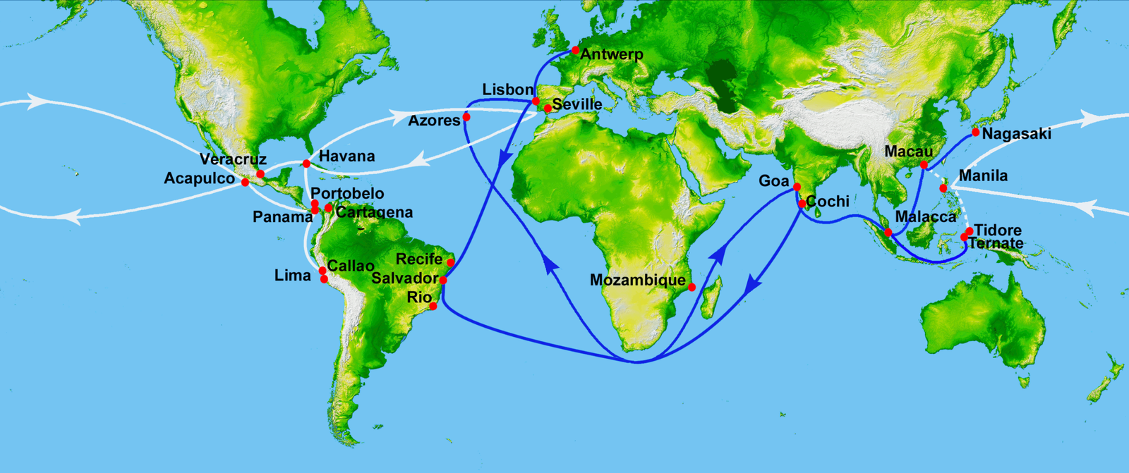
16th-Century Iberian Trade Routes
Chile's colonial economy was tied into the wider Spanish and Portuguese trading network that connected South America to Europe and Asia. Silver mined in the Andes moved along these routes for nearly three centuries, linking remote colonies like Chile to the global economy.
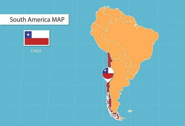
Chile's Latitudinal Range
Chile runs from about 17°30'S near the Peruvian border down to 56°S at Cape Horn — a span of roughly 39 degrees of latitude along the southwestern edge of South America, making it one of the longest north-south countries in the world.
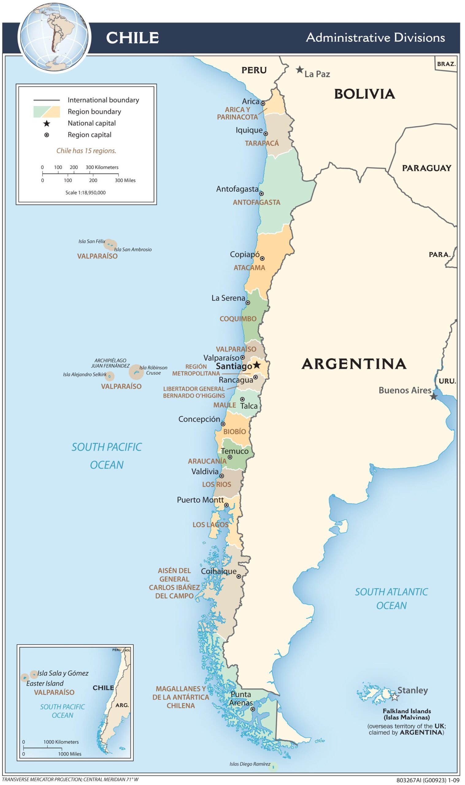
Chile Today (UTM Projection)
Chile's official mapping agency, the Instituto Geográfico Militar, uses the Universal Transverse Mercator (UTM) projection for its national maps. UTM minimizes distortion along a narrow north-south strip like Chile, unlike projections built for wider east-west countries.
East View Geospatial, n.d.; Instituto Geográfico Militar, 2025Research Questions
Where is Chile located?
Chile sits in South America along the southwestern coast, bordering the Pacific Ocean, with Peru to the north, Bolivia to the northeast, and Argentina to the east.
What is Chile's latitudinal range?
Chile spans from about 17°30'S to 56°S — roughly 39 degrees of latitude across 4,270 km, making it one of the longest north-south countries on Earth.
During what time periods has Chile existed?
The territory has been populated since roughly 10,000 BC. Spain colonized it starting in 1541, and it remained a Spanish colony until independence in 1818. The Republic of Chile has existed continuously since then.
Are there famous Chilean cartographers?
Yes — see the spotlight below.
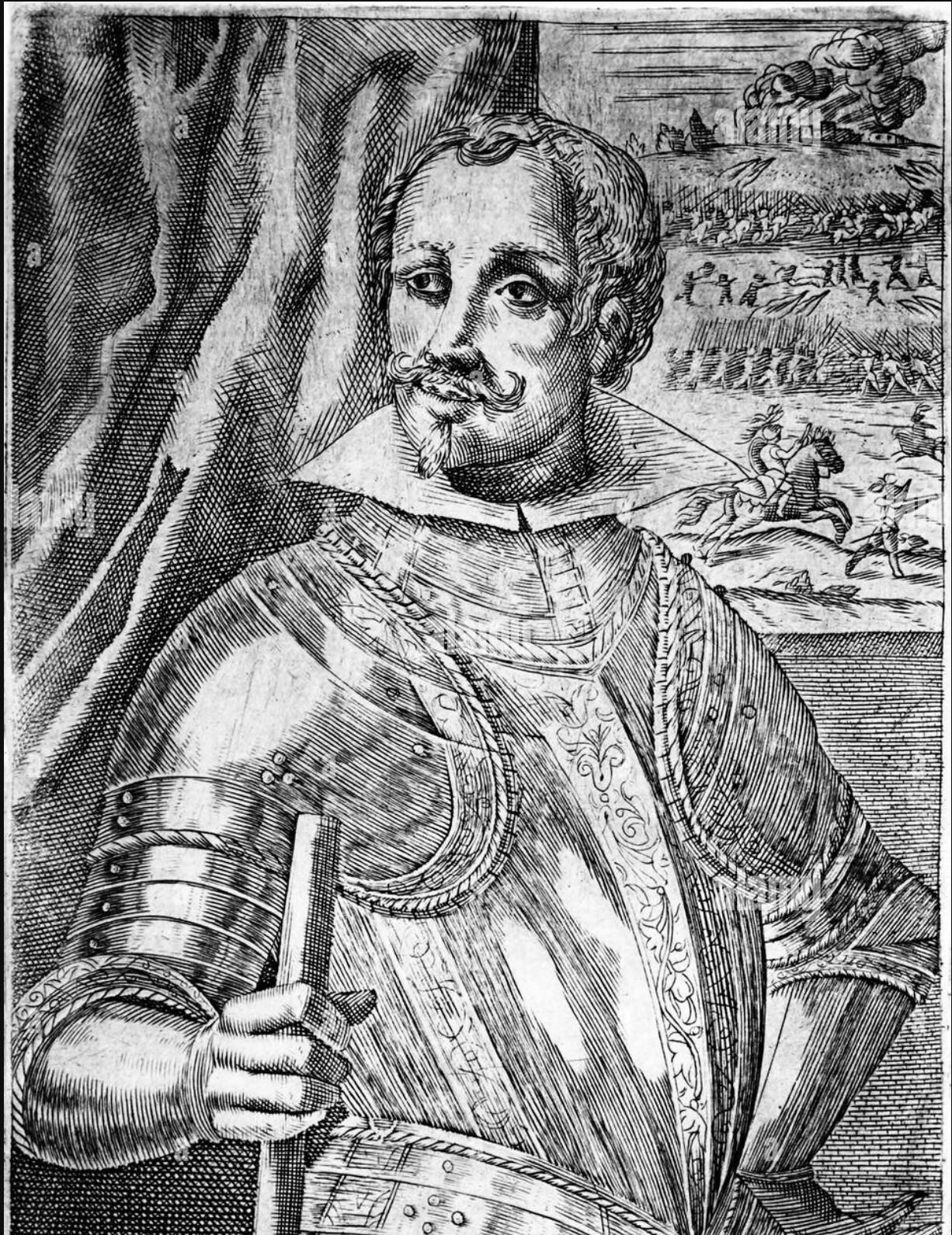
Alonso de Ovalle (1601–1651)
A Chilean-born Jesuit priest, Ovalle created the first printed map of Chile made by a native Chilean in 1646. Published in Rome alongside the first written history of Chile, his map became Europe's primary visual reference for the country for decades.